Multiple Choice
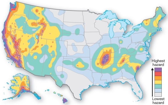 Earthquake hazard map for the United States.
Within the United States,which area has the highest earthquake hazards?
A) West Coast
B) East Cost
C) Gulf coast
D) mid-continent
E) upper Midwest
Correct Answer:

Verified
Correct Answer:
Verified
Q11: Discuss the process and causes of folding,and
Q12: Rough,sharp-edged lava is known as<br>A)pahoehoe.<br>B)obsidian.<br>C)peridotite.<br>D)scoria.<br>E)aa.
Q13: Increased seismicity in Colorado,New Mexico,and Oklahoma has
Q14: <img src="https://d2lvgg3v3hfg70.cloudfront.net/TB5538/.jpg" alt=" Folded mountains at the
Q15: Orogenesis refers to<br>A)the beginning of extensive faulting.<br>B)a
Q17: <img src="https://d2lvgg3v3hfg70.cloudfront.net/TB5538/.jpg" alt=" Types of faults
Q18: The nucleus of old crystalline rock in
Q19: The energy released by a magnitude 8
Q20: Lava that forms ropy cords in twisted
Q21: A description,such as "considerable-to-serious damage to buildings,"