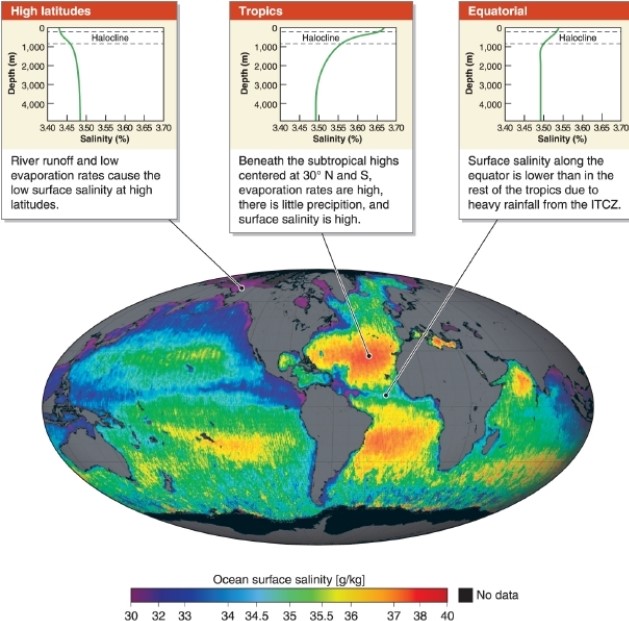
True/False

-A photo sequence showing progressive deforestation illustrates both temporal and spatial scales.
Correct Answer:

Verified
Correct Answer:
Verified
Q81: _ uses satellites to identify the locations
Q82: Erosion is the process of _ rock
Q83: <img src="https://d2lvgg3v3hfg70.cloudfront.net/TB8400/.jpg" alt=" -The crust is
Q84: An equal-area map projection<br>A)preserves the true areas
Q85: Explain the process by which people convert
Q87: Topography is _.<br>A)a geographic locating system<br>B)the height
Q88: <img src="https://d2lvgg3v3hfg70.cloudfront.net/TB8400/.jpg" alt=" -The
Q89: <img src="https://d2lvgg3v3hfg70.cloudfront.net/TB8400/.jpg" alt=" -Which
Q90: People depend on Earth's physical systems because
Q91: <img src="https://d2lvgg3v3hfg70.cloudfront.net/TB8400/.jpg" alt=" -An example of