Multiple Choice
-Which technology can be used to map rainfall in a hurricane?
A) Doppler radar
B) LIDAR
C) sonar
D) lasers
Correct Answer:

Verified
Correct Answer:
Verified
Q66: Which is an example of an anthropogenic
Q67: How many degrees of latitude separate the
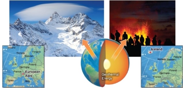
Q68: <img src="https://d2lvgg3v3hfg70.cloudfront.net/TB8400/.jpg" alt=" -The process of
Q69: Explain the history of Easter Island from
Q70: <img src="https://d2lvgg3v3hfg70.cloudfront.net/TB8400/.jpg" alt=" -Which statement describes
Q72: <img src="https://d2lvgg3v3hfg70.cloudfront.net/TB8400/.jpg" alt=" -The
Q73: <img src="https://d2lvgg3v3hfg70.cloudfront.net/TB8400/.jpg" alt=" -A GIS is
Q74: <img src="https://d2lvgg3v3hfg70.cloudfront.net/TB8400/.jpg" alt=" -The highest point
Q75: <img src="https://d2lvgg3v3hfg70.cloudfront.net/TB8400/.jpg" alt=" -The equator is
Q76: <img src="https://d2lvgg3v3hfg70.cloudfront.net/TB8400/.jpg" alt=" -Contour lines are