Multiple Choice
What does the DARK BLUE are on the map illustrate? 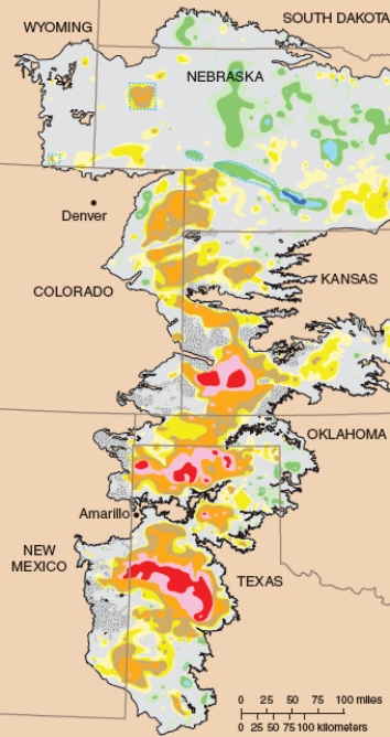
A) Areas of the High Plains Aquifer that contain the deepest water.
B) Areas of the High Plains Aquifer that have had most of the water removed.
C) Areas of the High Plains Aquifer that have run dry.
D) Areas of the High Plains Aquifer with high saltwater intrusion.
Correct Answer:

Verified
Correct Answer:
Verified
Q22: Why are urban areas more likely to
Q23: What is probably the BEST way for
Q24: What do the dashed lines shown in
Q25: Compare and contrast the three photographs below.
Q26: Why is water sometimes treated with ultraviolet
Q28: Wastewater, including sewage usually undergoes several treatments
Q29: The safe Drinking Water Act requires the
Q30: What is the major difference in the
Q31: What is gray water?<br>A)Water used in industrial
Q32: Which of the following BEST describes the