Multiple Choice
We have a layer representing rivers and another layer representing septic tanks on farm properties. We would like to identify which septic tanks are located within the 200m riparian zones. Which model should we use?
A) 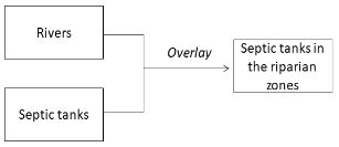
B) 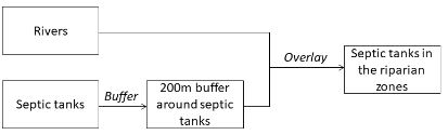
C) 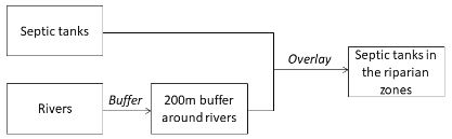
D) 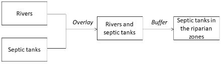
Correct Answer:

Verified
Correct Answer:
Verified
Related Questions
Q18: A distance surface map (e.g., the proximity
Q19: Raster overlay is more commonly used than
Q20: IDW, second-order trend surface, regularised spline and
Q21: To delineate a 200m riparian zone for
Q22: If you cannot give a scientific justification
Q24: Spatial interpolation is<br>A) the procedure of combining
Q25: With which of the following weight values
Q26: To examine which crops grow on which
Q27: The purpose of fitting a semivariogram with
Q28: To answer the question of 'how many