Multiple Choice
Covariation, as seen in the two maps, is described as 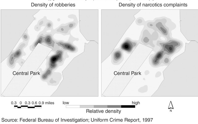
A) how a spatial pattern varies through space on a map.
B) how two similar mapped patterns can be compared to help explain a phenomenon.
C) how a choropleth map divides its data into classes for easier understanding.
D) how isoline maps portray continuous data.
Correct Answer:

Verified
Correct Answer:
Verified
Q13: To what maximum extent is latitude measured?<br>A)To
Q14: To say a pattern is random is
Q15: The map of Afghanistan and Pakistan best
Q16: Since all longitude lines are essentially the
Q17: For this map we might say the
Q19: Place is different from space in that<br>A)Place
Q20: In considering movement of commuters in central
Q21: Overall, the most important criteria in understanding
Q22: A geographical coordinate system on the Earth
Q23: Which of the following is the best