Essay
Refer to the geologic province map (fig.13.18)to answer the question(s)below.
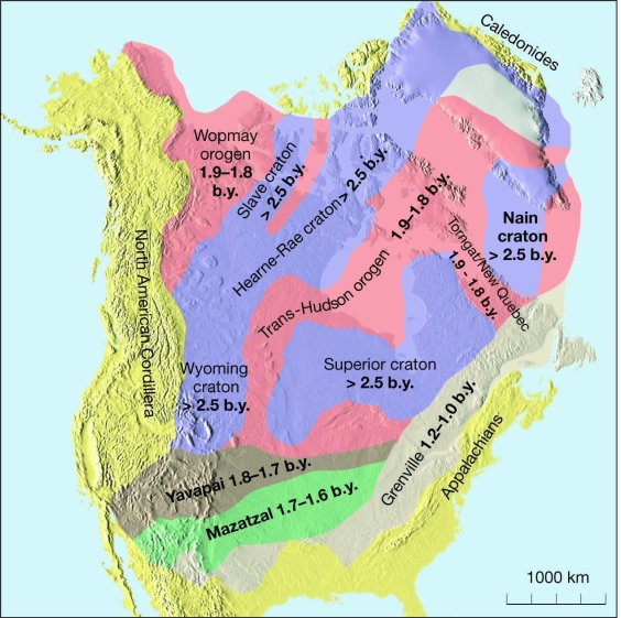
-What does the Superior craton represent?
Correct Answer:

Verified
The oldest continental crust, ...View Answer
Unlock this answer now
Get Access to more Verified Answers free of charge
Correct Answer:
Verified
The oldest continental crust, ...
View Answer
Unlock this answer now
Get Access to more Verified Answers free of charge
Related Questions
Q76: Rift valleys with mafic volcanics are _
Q77: What mechanism is proposed for Cretaceous subsidence
Q78: Since the early Mesozoic, the _ has
Q79: The Himalayan Mountains and Tibetan Plateau are
Q80: Soft, easily-eroded strata high in a mountain
Q82: An exotic terrane created by a seamount
Q83: Refer to the geologic province map (fig.13.18)to
Q84: Intensely folded, thinly bedded, Paleozoic shales and
Q85: Refer to the geologic province map (fig.13.18)to
Q86: British Columbia is "accreted terrane central" as