Essay
Refer to the geologic province map (fig.13.18)to answer the question(s)below.
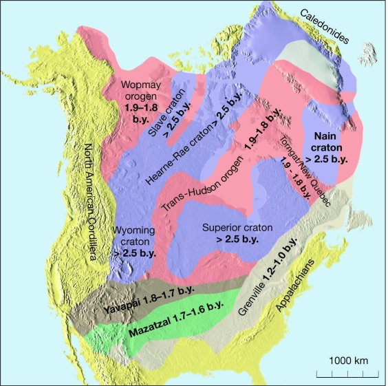
-What do the 1.8 to 1.7, 1.7 to 1.6, and Grenville belts represent?
Correct Answer:

Verified
orogenic belts added...View Answer
Unlock this answer now
Get Access to more Verified Answers free of charge
Correct Answer:
Verified
orogenic belts added...
View Answer
Unlock this answer now
Get Access to more Verified Answers free of charge
Related Questions
Q12: Active volcanic arcs above a young oceanic
Q13: What must happen to a region of
Q14: Mountainous relief is due to the rotation
Q15: Ophiolites, like at Thetford Mines Quebec, can
Q16: What are two different ways or forms
Q18: Whether or not there are active tectonic
Q19: As thrusting builds up the elevation of
Q20: The most likely place for a high
Q21: As the Pleistocene ice sheets in Canada
Q22: Rugged elevations are due to crustal extension,