Multiple Choice
Colors on this map of an imaginary country represent mean annual temperatures (reds above 28 degrees Celsius,blue and purple below 0 degrees Celsius) . In classifying the climate of this imaginary country,the hottest and driest areas are in the 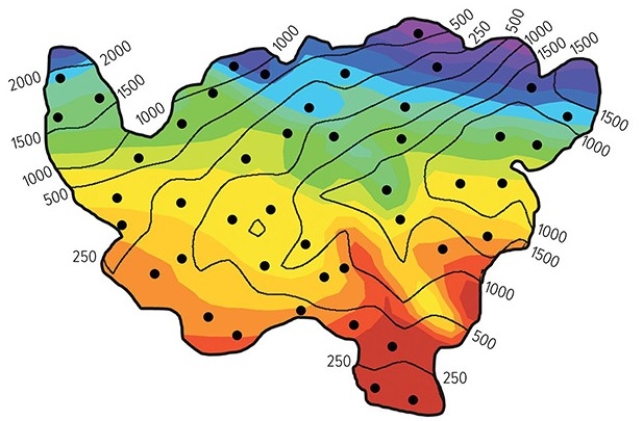
A) northeast.
B) southeast.
C) southwest.
D) northwest.
Correct Answer:

Verified
Correct Answer:
Verified
Q61: B type climates generally occur<br>A)along the equator.<br>B)beneath
Q62: Both sea surface (below)and air temperature (above)show
Q63: Which of the following explains the very
Q64: Given that climate correlates closely with vegetation,what
Q65: On the hypothetical Daisy World planet,black daisies
Q67: A higher proportion of black daisies on
Q68: The Cwa climate of Lucknow,India owes its
Q69: Where there are abrupt changes in elevation,climate
Q70: Which of the following would not be
Q71: This globe,from the opening two-page spread of