Multiple Choice
On the map of trade routes in the Middle Ages the green lines signify ____________ while the purple lines are __________________. 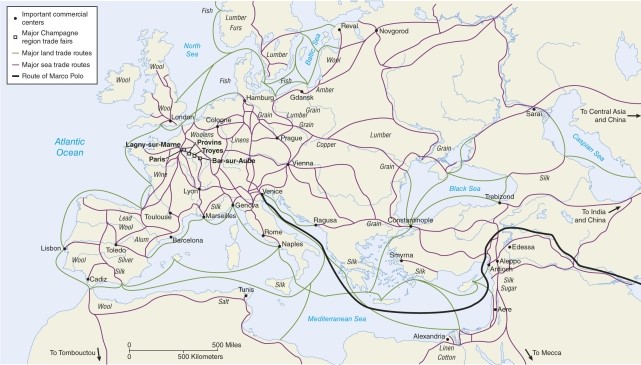
A) political boundaries;cultural watersheds
B) mountainous physical boundaries;railroads
C) sea routes;land routes
D) German roads;Roman roads
Correct Answer:

Verified
Correct Answer:
Verified
Related Questions
Q17: Which of the following is not a
Q18: Though India is large with a large
Q19: Agglomeration activities<br>A)allow cities to focus heavily on
Q20: After the Roman Empire the entire basis
Q21: Which city could be seen as extra
Q23: According to the map of world urban
Q24: Over time the percent of population on
Q25: With the development of agriculture, settlements occurred
Q26: On the graph of growth of British
Q27: In the Roman Empire, roads connected cities