Exam 1: Climates Around the World, Energy, Matter in the Atmosphere, Soil, Unstable Slopes, Streams, Lakes, Groundwater, Glaciers, Shorelines, and Changing Seal Levels
Exam 1: Climates Around the World, Energy, Matter in the Atmosphere, Soil, Unstable Slopes, Streams, Lakes, Groundwater, Glaciers, Shorelines, and Changing Seal Levels10 Questions
Exam 2: Our Universe28 Questions
Exam 3: Earth Materials13 Questions
Exam 4: Plate Tectonics, Earth History, Deformation, Earthquakes, Volcanism and Other Igneous Processes6 Questions
Exam 5: Sculpting Landscapes18 Questions
Select questions type
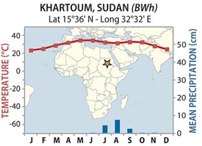
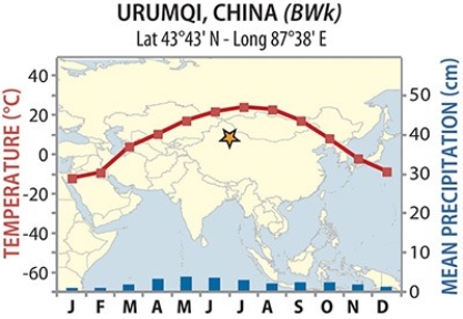
18)Though Khartoum and Urumqi both have dry BW climates, temperatures are much more variable for Urumqi. Why?
Free
(Multiple Choice)
4.9/5  (36)
(36)
Correct Answer: Verified
B
136)The Ogallala Aquifer is located:
Free
(Multiple Choice)
4.8/5 (35)
Correct Answer:Verified
C
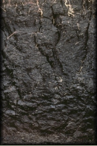
80)The clay-rich soil pictured below is a
Free
(Multiple Choice)
4.8/5 (27)
Correct Answer:Verified
C
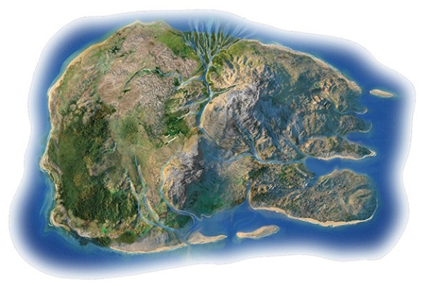
106)In the shorelines investigation, what shoreline feature is present along the eastern part of the north shore?
(Multiple Choice)
4.7/5 (32)
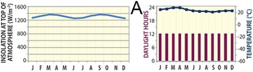
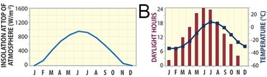
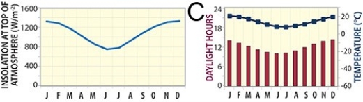
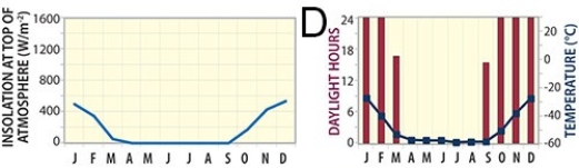
73)Which of these graphs represents a site near the equator, such as near Ecuador?
(Multiple Choice)
4.9/5 (40)
72)Which of the following sites in South America would be likely be most impacted by clouds, decreasing the amount of electricity generated from solar energy?
(Multiple Choice)
4.9/5 (35)
71)Which of the following sites in South America would be best for generating electricity from solar energy, if clouds were NOT a factor?
(Multiple Choice)
4.9/5 (40)
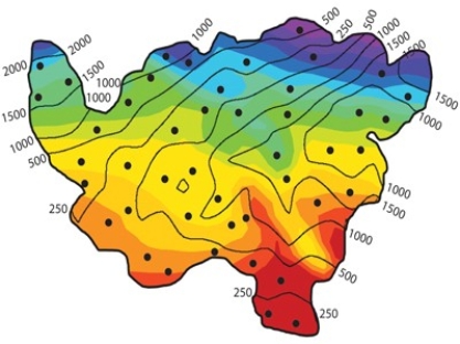
2)In classifying the climate of this imaginary country, the wettest and coolest areas are in the ______. The colors represent temperatures (warmest is red, coolest is purple), and the contour lines represent average precipitation in millimeters.
(Multiple Choice)
4.9/5 (30)
Filters
- Essay(0)
- Multiple Choice(0)
- Short Answer(0)
- True False(0)
- Matching(0)